The South West is full of sheltered anchorages, some of which are well known and often full of other cruising boats and there are others known only to those that have cruised these waters for several years.
Here are a few of our members’ favourites in no particular order;
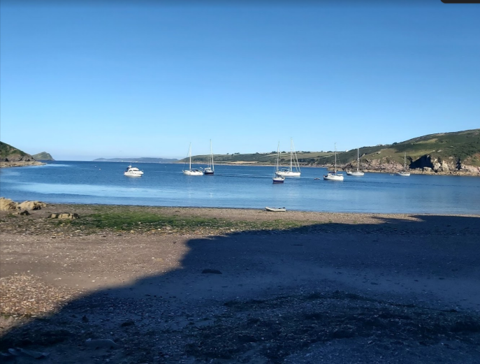
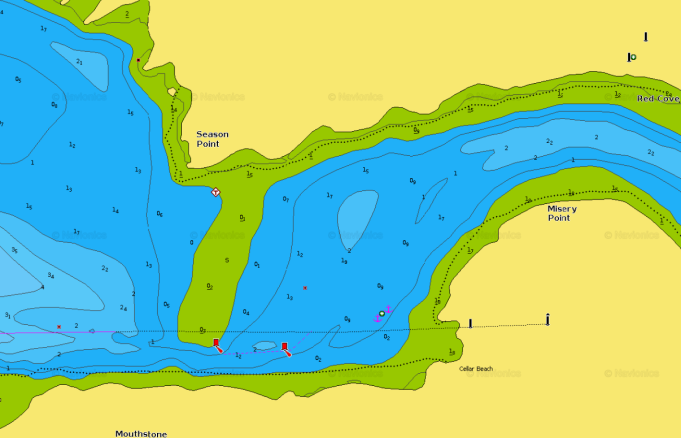
Cellar Bay, River Yealm
Shelter from NW through N to South. Open to S through to W.
Okay holding in sand and shingle, some weed and regular passing traffic leaving and entering the R Yealm.
50° 27′.77N 4° 12′.31W
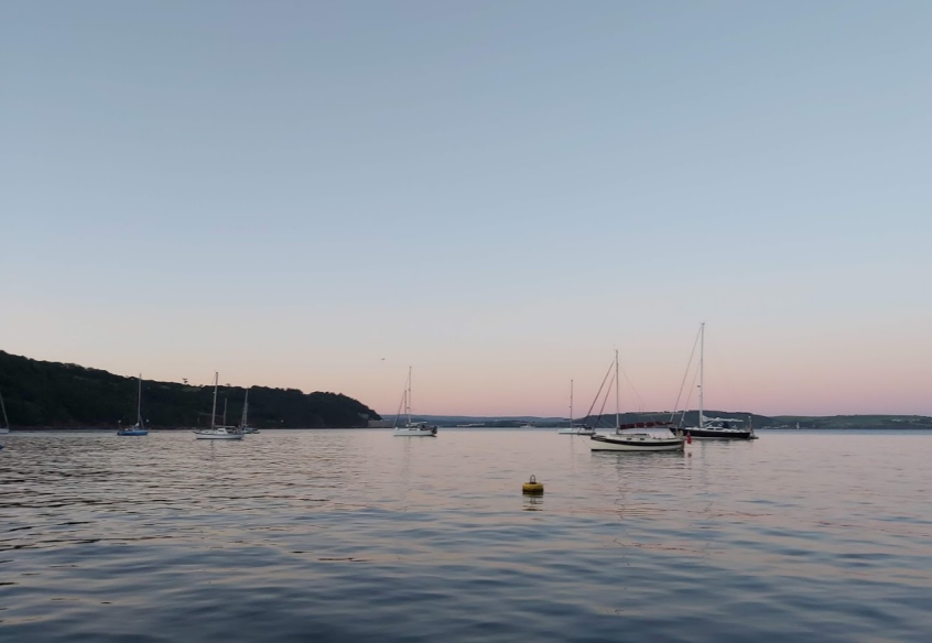
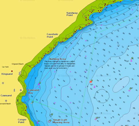
Kingsand and Cawsand
The classic overnight anchorage on entering or before leaving Plymouth Sound.
Shelter from SW through W and N to NNE. Open to NE through to South.
Good holding in sand, but beware of eelgrass beds, swimmers and crowds!
50° 19′.86N 4° 11′.58W
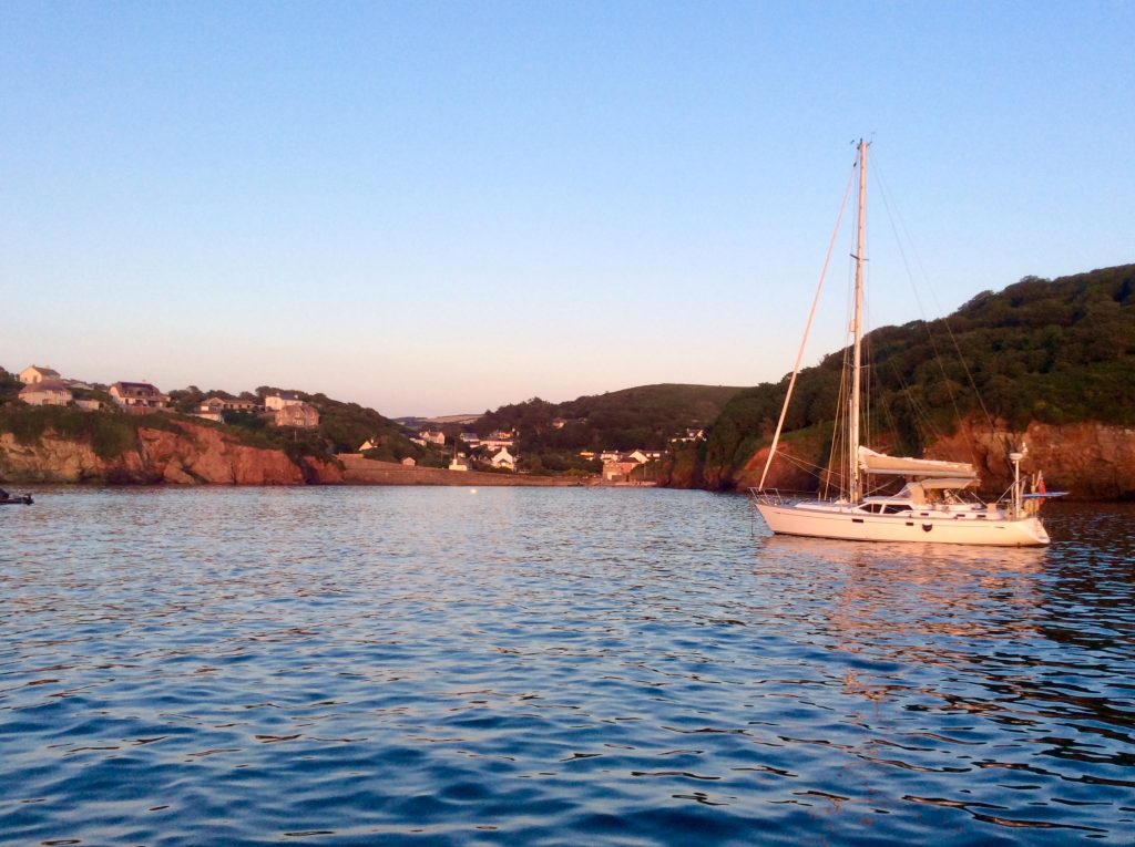
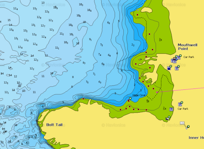
Hope Cove
Shelter from SSE through E to N. Open from SW to NW.
Excellent holding although prone to swell following persistant westerlies. Excellent catering and village shop ashore.
50° 14′.68N 3° 51′.90W
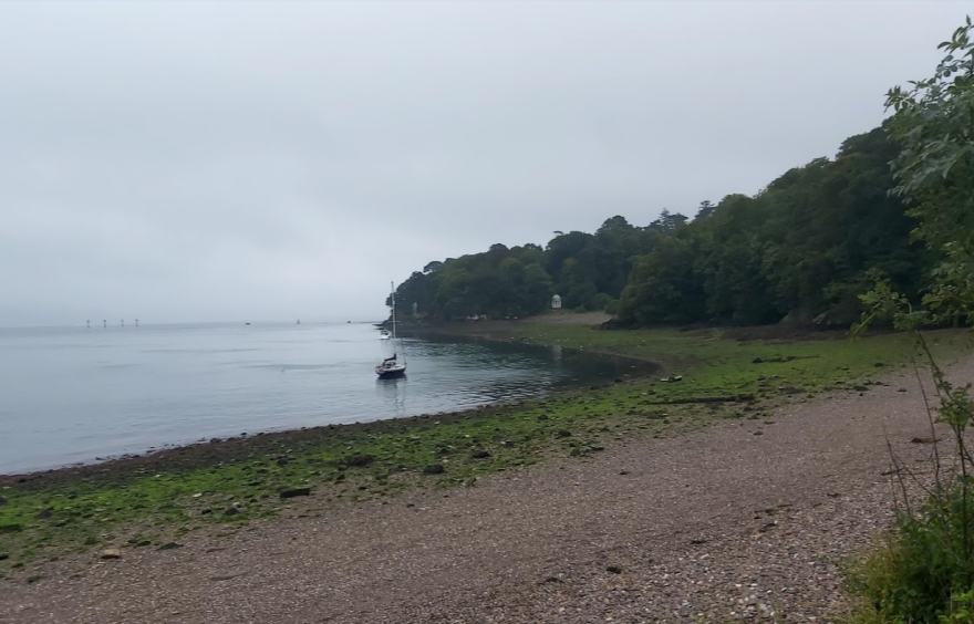
Barn Pool, Plymouth
If it was good enough for Darwin’s Beagle, its probably good enough for you too! The Beagle lay at anchor here before departing on its famous voyage to the Galápagos Islands.
Good holding but you will need to be close in as the bottom shelves very steeply. Keep an eye on your scope as you are likely to be close to other boats. An extraordinary vantage point to watch large warships entering and leaving Devonport or to view the air displays on Armed Forces Day!
Shelter from SSE through S to NW, although strong winds can create unpredictable gusts over the Mount Edgecumbe Park and estate.
50° 21′.35N 4° 10′.27W
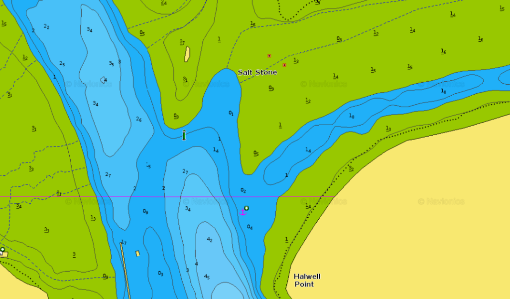
The Saltstone and the mouth of Frogmore Creek, Salcombe Harbour.
Salcombe isn’t everybody’s cup of tea, but in good weather and out of the peak season it is a jolly lovely place to be! Easy access to all shoreside facilities and the new Co-op suppermarket near the Shadycombe carpark. On the right tides there is also excellent dinghy access to the eateries and hostelries of Kingsbridge, Frogmore and South Pool. Err as close to the mouth of Frogmore Creek as the tide and your nerves permit to avoid the inevitable rush hour of speedboats returning from Kingsbridge on evening high tides. You will have to pay Salcombe Harbour dues to anchor here, but the scenery is lovely and you will never have been relieved of your £12.00 in such a courteous way as the Salcombe Harbour team achieves!
Excellent holding in mud and sand.
50° 15′.12N 3° 45′.53W
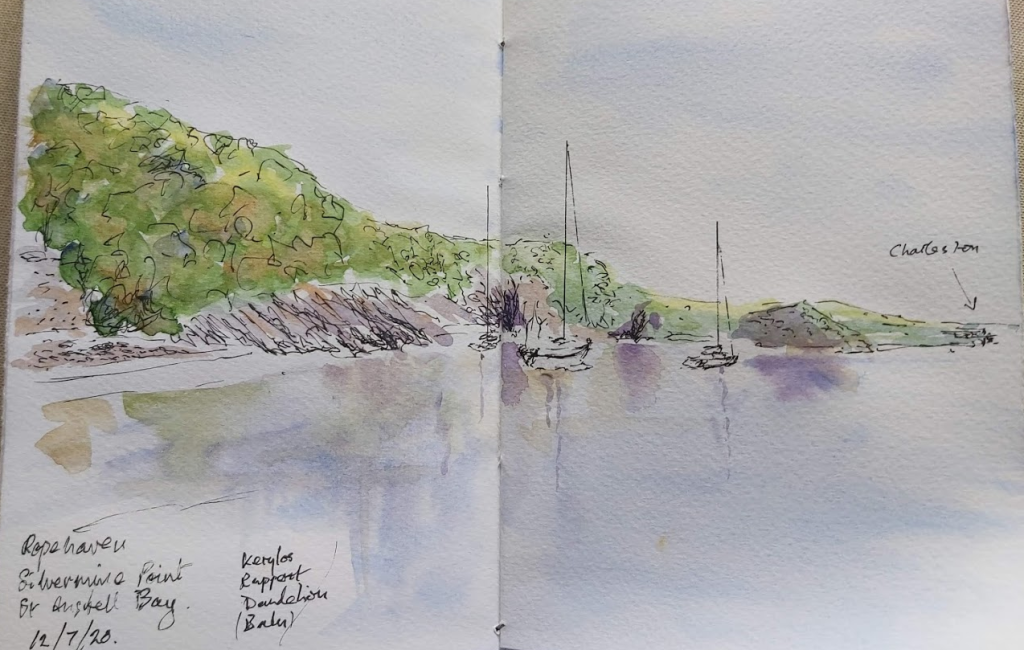
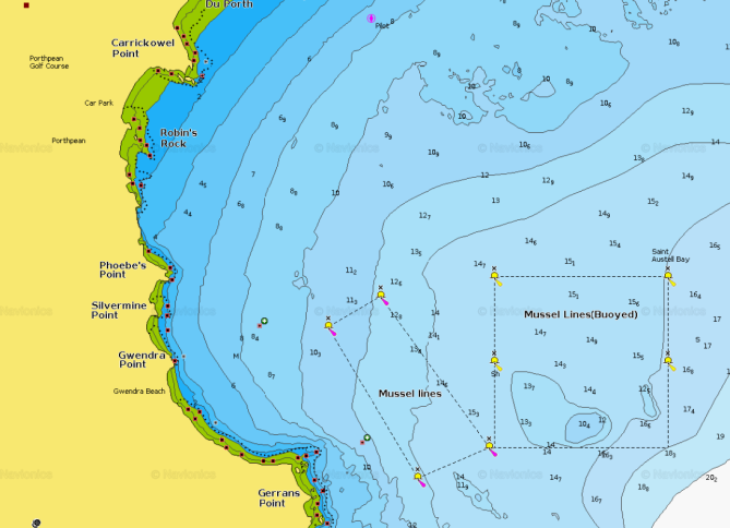
Silvermine Point, St Austell Bay
Close to the historic and picturesque Charlestown Harbour (Star of Poldark, The Onedin Line and many other TV and film dramas) and a short hop away from the very busy port of Fowey.
Shelter from SW through W to NE. Open to E & SE. Sand and weed. Beware of the mussel farm to seaward.
50° 18′.71N 4° 45′.67W
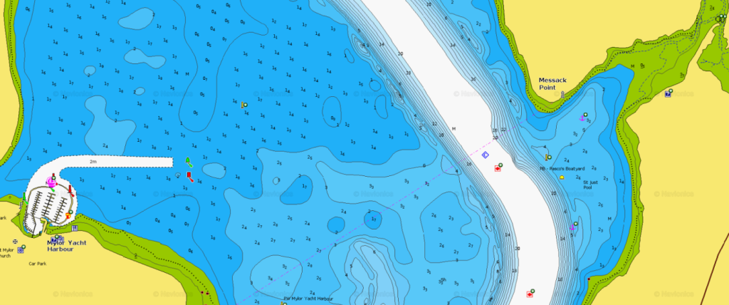
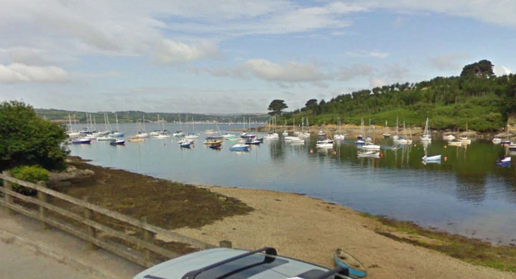
St Just in Roseland
Diectly opposite Mylor Yacht Harbour on the River Fal and considerably less expensive!
Sheltered from NNW through E to SSE. Good holding in mud and sand.
50° 10′.83N 5° 1′.38W
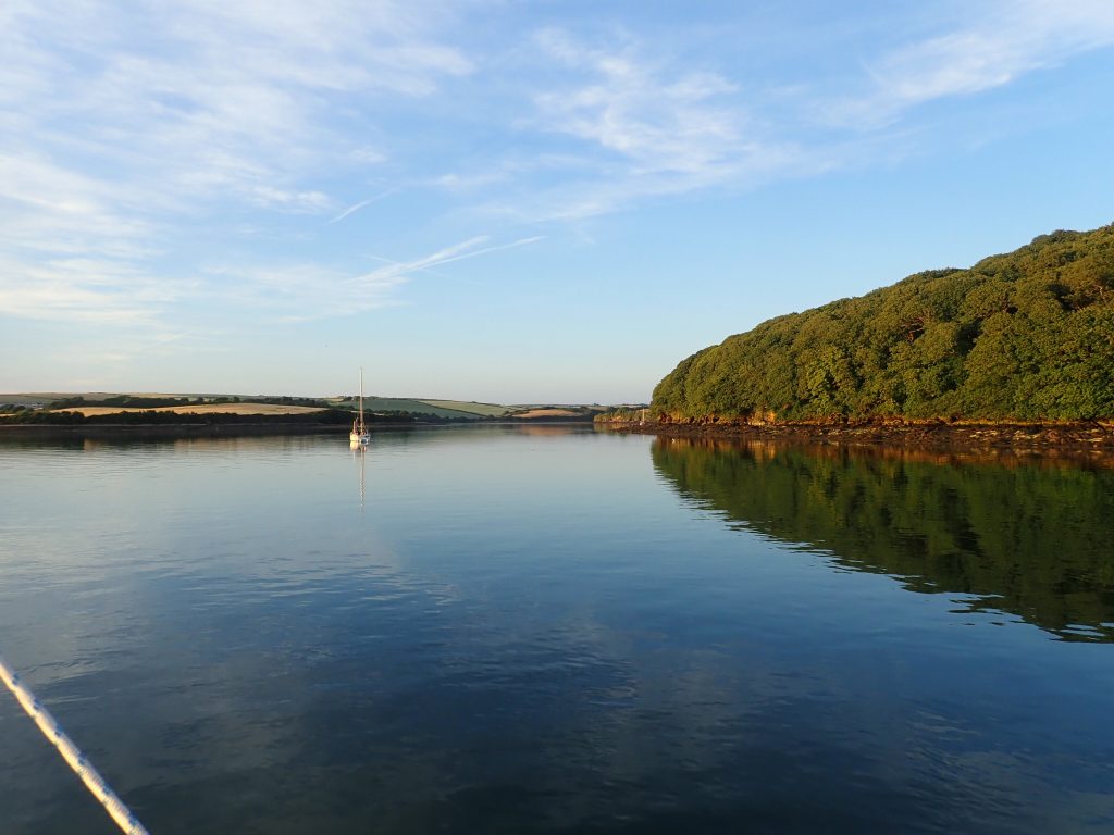
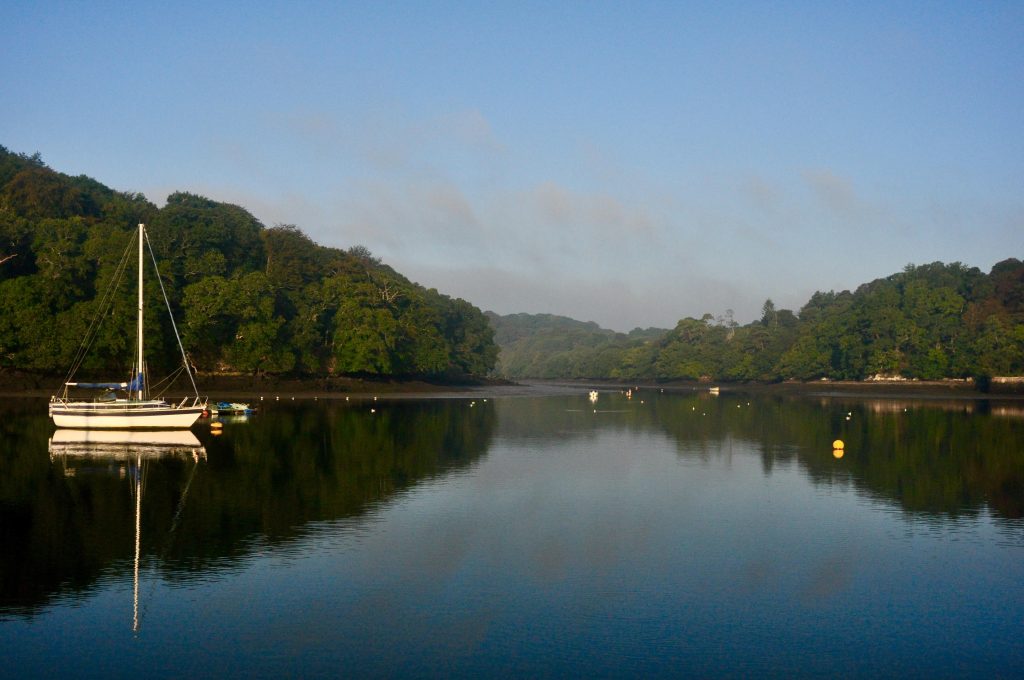
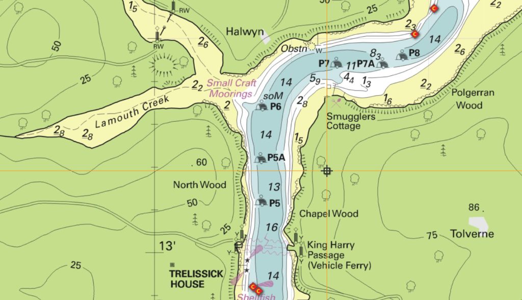
Mouth of Cowlands and Lamouth Creek, River Fal
Under the shadow of a bronze age settlement and a short dinghy ride from the visitor pontoon at the National Trust’s Trelissick Estate, this sheltered anchorage is a great place to ride out a storm. The estate provides a pleasant way to spend a day ashore whether walking or visiting the house itself.
Sheltered from all directions, although strong southerly winds can funnel up the river. Excellent holding in mud and sand.
50° N 13′.34N 5° 1′.66W
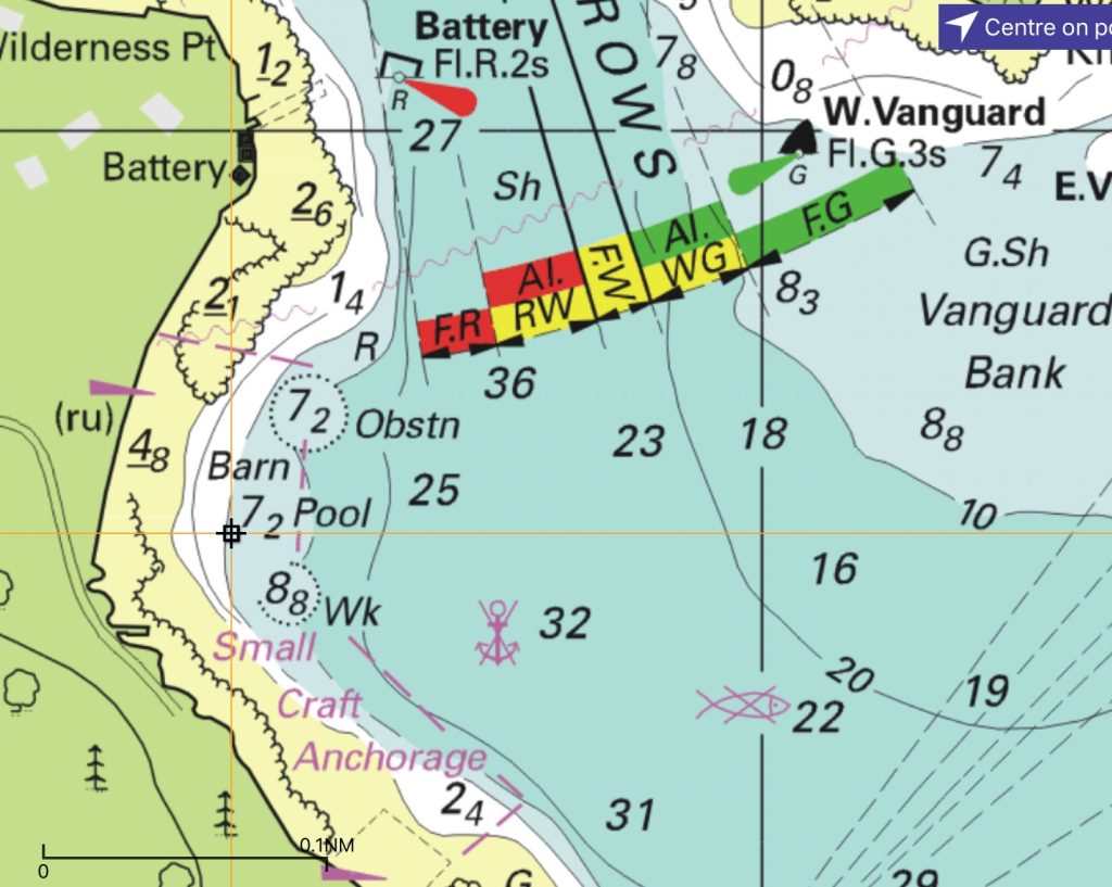
Dandy Hole, River Lyhner
The most famous “secret” anchorage in the South West! Access to Wacker Quay 2 hours either side of high water with walks to the village of Antony and its gastro pub the Carew Arms.
Shelter from all directions except strong easterlies.
50° 22′.52N 4° 16′.34W
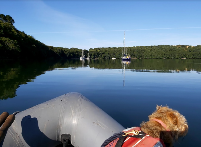
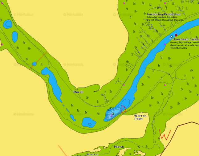
For the very latest information regarding the prcise location of the Dandy Hole, visit our blog post, The Dandy Hole Has Moved!
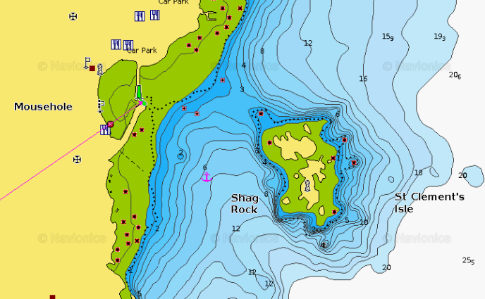
Mousehole
Once the main port in Mounts Bay, Mousehole is now a picturesque but busy village about 2.5 miles south of Penzance and Newlyn. St Clements Isle lies just offshore and helps to provide shelter from NW through N to NE. Holding is good in sand and broken shell.
50° 4′.92N 5° 32′.16W
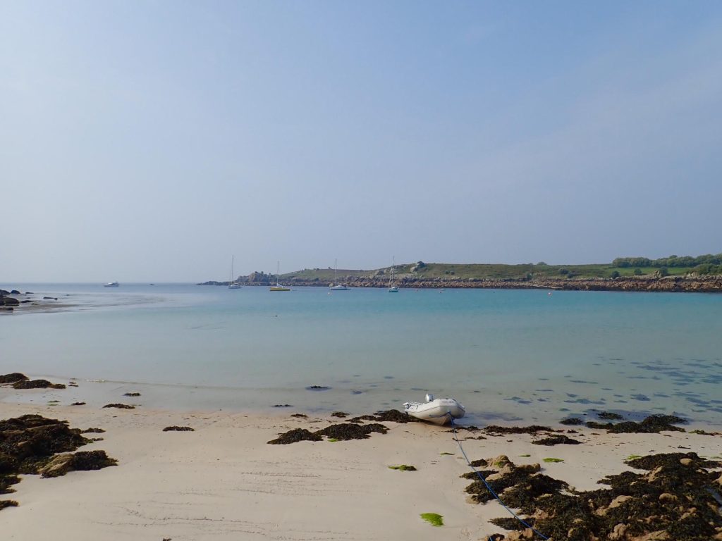
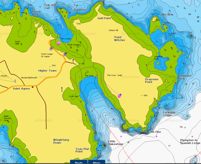
The Cove, Saint Agnes & Gugh, Isles of Scilly
Excellent, if sometimes crowded anchorage between the twin islands of Saint Agnes and Gugh. Access ashore to a small village shop and post office, the popular Turks Head pub and ferry access to the other main islands.
Excellent holding in sand. Provides shelter from SSW through W through N to ESE.
49° 53′.44N 6° 20′.11W
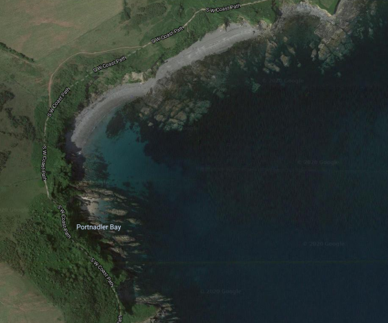
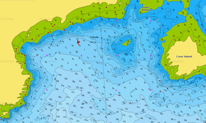
Portnadler Bay, Looe
Shelter from NW to N. Open from SW through S to E. Mixture of good holding in sand and rocky patches.
50° 20′.22N 4°28′.18W
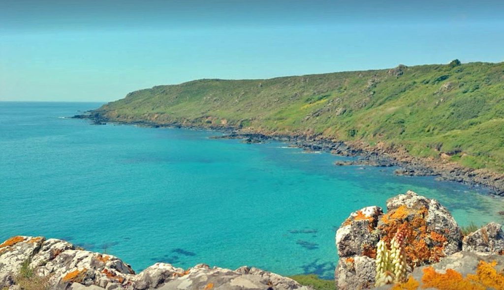
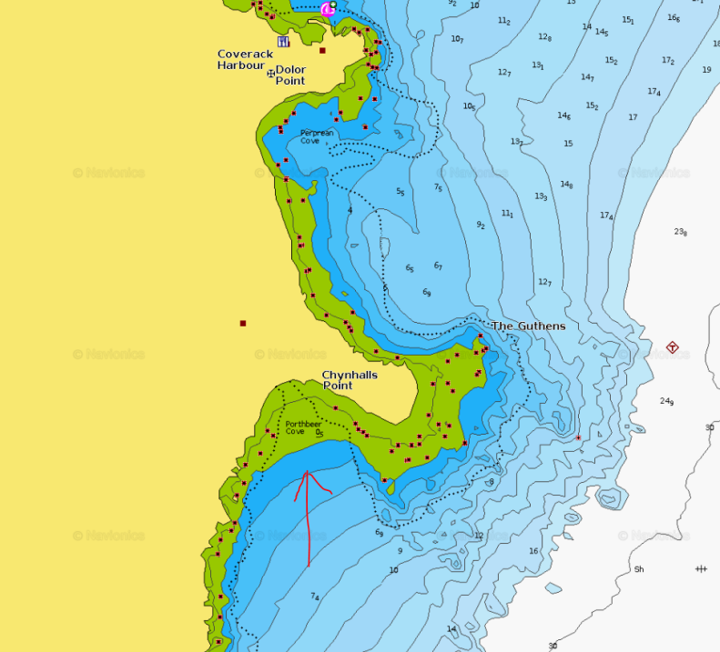
Porthbeer, South of Coverack, Lizard penninsula
A sheltered sandy cove just south of Chynhalls Point. a short distance south of Coverack. At high water the fine sandy beach is often completely covered but after a sustained stormy period, the sand is often striped back to a stoney collection of boulders of the local serpentine rock.
50° 50 0′.78N 5° 5′.64W
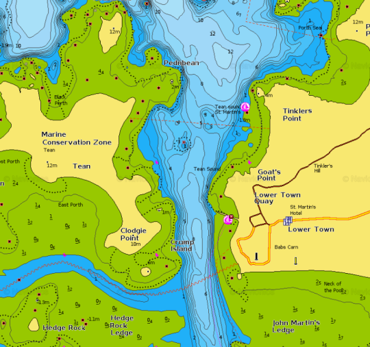
Tean Sound, between Tean & St Martins, Isles of Scilly
49° 57′.95N 6° 18′.34W
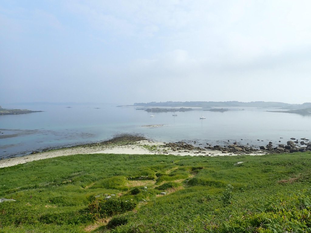
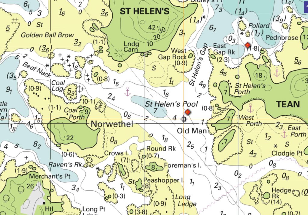
Saint Helen’s Pool, Isles of Scilly
Good shelter from most directions in the pool south of the old quarantine island of Saint Helen’s. Approach from the NE through St Helen’s Gap with care!
49° 58′.02N 6° 19′.29W