
The new era of citizen charting, bought about by the latest chart plotters that can record and share their data, is enabling more up to date and detailed information for small boat navigation.
The latest area to receive this treatment is the well loved Dandy Hole on the River Lynher.
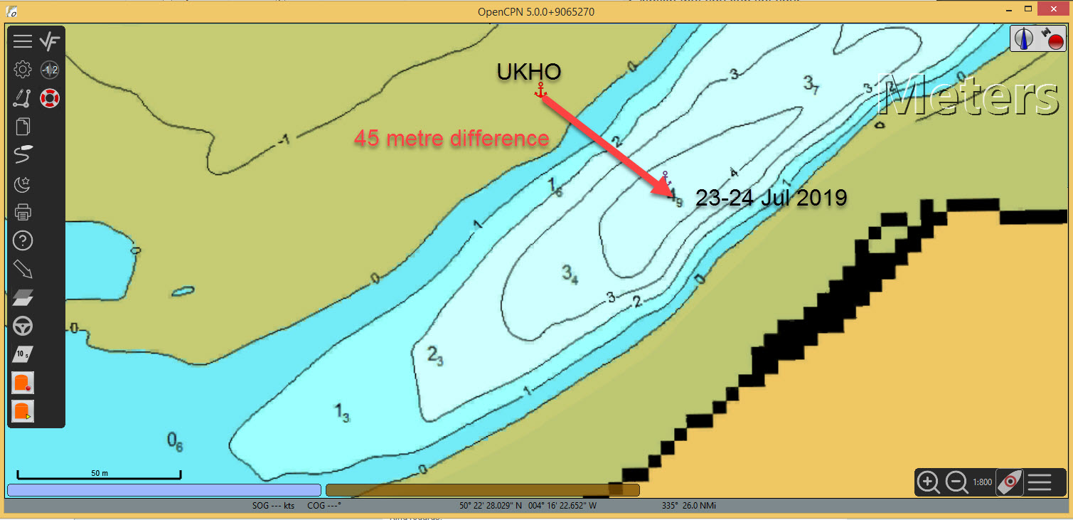
Local sailor Mike Rossiter has shared this recent survey shown below.

For those able to use ‘KAP’ charts that can be shown in OpenCPN or other suitable PC navigation programs, Mike has also made available a .kap file. Unfortunately, we can’t upload this file to our website for security reasons, but if you would like a copy emailed to you, please contact the Website Editor at info.wqsc@gmail.com.
As always, please use this information alongside all other sources of navigation support and exercise good seamanship at all times.
Leave a Reply