Pilotage up-river to Weir Quay .
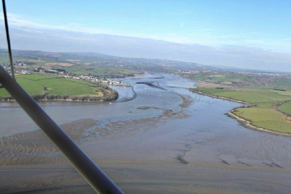
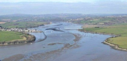
These photos were taken by Ted Coryton, the pilot of the aircraft, during the equinoctial spring tides of 2011.
They show the shallow patches below Cargreen, and they shouldn’t have changed much in the years since then.
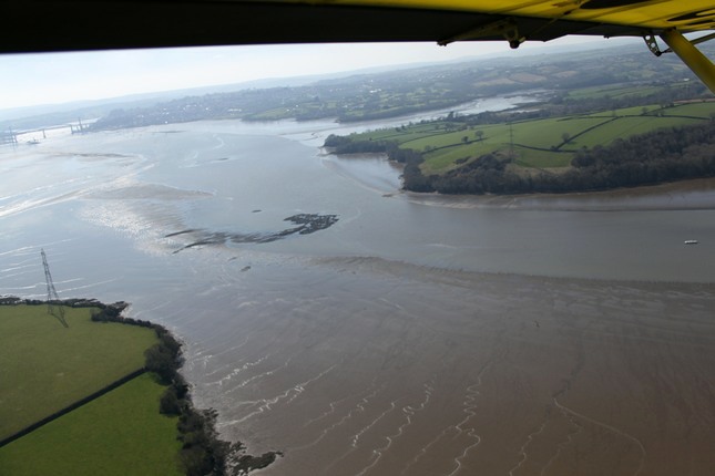
(With thanks to Ted Coryton and Simon Martin)
Tamar river deep channel Neal Point to Weir Point
The following pilotage notes were provided by club member Mick Johnson in 2011.
The way points below were made along a transit line defined by aligning the Warren Point starboard hand buoy with the conspicuous yellow derricks at Ernesettle ammunition pontoon which is just upstream of the Tamar bridges on the Devon side.
The Warren Point Buoy is the second green heading downstream after passing Cargreen. The transit line is a good fit with the charted channel.
Close after low water on one of the lowest spring tides (LW Devonport at 1221 GMT height 0.1 m) in 2011. The channel was sounded at all these way points and found to be more than 2.3 metres deep. My stick was only 2.5m!
WP 5 N 50 25’ 77 W 04 11’ 92 WP 6 N 50 25’ 86 W 04 11’ 91
WP 7 N 50 26’ 01 W 04 11’ 88 WP 8 N 50 26’ 08 W 04 11’ 87
WP 9 N 50 26’ 15 W 04 11’ 86 WP10 N 50 26’ 23 W 04 11’ 86
This transit is the one I have followed for many years to negotiate the channel over the mussel beds without difficulty . The way points may prove useful in poor visibility, especially if a strong cross tide is running which could set you onto the mud.